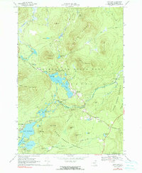
1968 Map of Loon Lake
USGS Topo · Published 1990About this map
The North Branch Saranac River winds through this high-country landscape of the Adirondack State Park, revealing a network of water and early transportation routes in Franklin County. This late-1960s environment is shaped by the transition from industrial uses to recreation, where the Old Plumadore Grade and other rail corridors trace the paths of former logging and mountain transit. Significant water bodies like Loon Lake, Lake Kushaqua, and Buck Pond serve as focal points for both seasonal and permanent settlements such as Gabriels and Merrillsville. The map captures distinct local identifiers like the White Fathers site and the secluded Merrillsville Cemetery, providing a precise look at the geography before modern development intensified. Between the Loon Lake Mountains and the Belmont Range, the terrain is punctuated by small-scale resource extraction at local sand and gravel pits.
Find a feature on this map
58 named features on this map. Tap any name to fly to it.
Don’t see what you’re looking for? This feature index may not catch every label — zoom into the map to look around manually.
Map Details
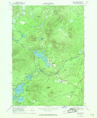
Editions of this 1968 Loon Lake Map
2 editions found
Other maps of this area

1896 · Lake Placid
USGS Topo · 1:62,500

1898 · Lake Placid
USGS Topo · 1:62,500

1902 · Saranac
USGS Topo · 1:62,500

1904 · Saranac
USGS Topo · 1:62,500

1906 · Loon Lake
USGS Topo · 1:62,500

1908 · Loon Lake
USGS Topo · 1:62,500

1911 · Lyon Mountain
USGS Topo · 1:62,500

1913 · Lyon Mountain
USGS Topo · 1:62,500

1931 · Lyon Mountain
USGS Topo · 1:62,500

1948 · Ogdensburg
USGS Topo · 1:250,000