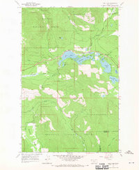
1966 Map of Loon Lake
USGS Topo · Published 1970About this map
Kootenai National Forest dominates this mid-1960s landscape, where a dense network of mountain lakes and creeks converges in the Fisher River valley. The map centers on a chain of glacial waters including Loon Lake, Leon Lake, and the uniquely shaped Horseshoe Lake. Settlement is sparse, focused around Happys Inn and the southern reaches of McGinnis Meadows, reflecting a remote mountain economy centered on timber and seasonal recreation. Numerous Picnic Areas dot the shoreline of Crystal Lake and Little Loon Lake, while the topography shows the transition from the low-lying Pleasant Valley to the steep ridges of the surrounding national forest land. In the southern portion of the quadrangle, the terrain descends into the wide flats of Elk Park, where Elk Creek begins its drainage through the heavily forested interior.
Find a feature on this map
29 named features on this map. Tap any name to fly to it.
Don’t see what you’re looking for? This feature index may not catch every label — zoom into the map to look around manually.
Map Details
Editions of this 1966 Loon Lake Map
2 editions found
Other maps of this area

1920 · Jennings
USGS Topo · 1:125,000

1935 · Thompson Lakes
USGS Topo · 1:96,000

1937 · Thompson Falls
USGS Topo · 1:125,000

1942 · Thompson Lakes
USGS Topo · 1:125,000

1956 · Wallace
USGS Topo · 1:250,000

1957 · Kalispell
USGS Topo · 1:250,000

1960 · Kalispell
USGS Topo · 1:250,000

1960 · Wallace
USGS Topo · 1:250,000

1961 · Kalispell
USGS Topo · 1:250,000
1966 · Fisher Mountain
USGS Topo · 1:24,000