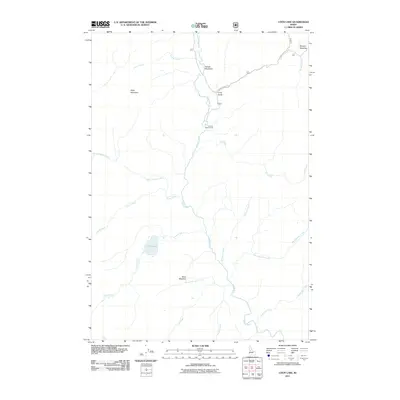
2011 Map of Loon Lake
USGS Topo · Published 2011About this map
Ruby Mountain overlooks a landscape defined by the winding course of the Secesh River and its numerous high-country tributaries in Idaho County. This 2011 survey illustrates a region largely characterized by its hydrology and natural clearings, such as Secesh Meadows and Stratton Meadow in the northeast. The central feature, Loon Lake, serves as the headwaters for Loon Creek, which joins the river system near Enos Meadow.
Find a feature on this map
21 named features on this map. Tap any name to fly to it.
Don’t see what you’re looking for? This feature index may not catch every label — zoom into the map to look around manually.
Map Details
Editions of this 2011 Loon Lake Map
This is the sole edition of this map. No revisions or reprints were ever made.
Other maps of this area

1956 · Burgdorf
USGS Topo · 1:62,500

1956 · Warren
USGS Topo · 1:62,500

1956 · Elk City
USGS Topo · 1:250,000

1960 · Elk City
USGS Topo · 1:250,000

1969 · Loon Lake
USGS Topo · 1:24,000

1969 · Pony Meadows
USGS Topo · 1:24,000

1969 · Enos Lake
USGS Topo · 1:24,000
1969 · Box Lake
USGS Topo · 1:24,000

1969 · Williams Peak
USGS Topo · 1:24,000
1969 · Victor Peak
USGS Topo · 1:24,000