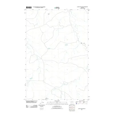
2011 Map of Loony Hollow
USGS Topo · Published 2011About this map
O'Fallon Creek and its southern tributaries, Whitney Creek and Ash Creek, define this Prairie County landscape in the early twenty-first century. The map documents a sparsely populated ranching or agricultural environment where water management is critical, as evidenced by Marshall Dam, Gray Number 1 Dam, and the Horse Reservoir. Small rural locales like Loony Hollow and Shoemaker are connected by a network of local roads and 4WD tracks that navigate the drainage basins. Transportation infrastructure is represented by the railroad at Lacomb Siding in the northeast, while the presence of the Archdale Reservoir further highlights the systematic collection of seasonal runoff in this part of Montana.
Find a feature on this map
11 named features on this map. Tap any name to fly to it.
Don’t see what you’re looking for? This feature index may not catch every label — zoom into the map to look around manually.
Map Details
Editions of this 2011 Loony Hollow Map
This is the sole edition of this map. No revisions or reprints were ever made.
Other maps of this area

1953 · Miles City
USGS Topo · 1:250,000

1957 · Miles City
USGS Topo · 1:250,000

1958 · Miles City
USGS Topo · 1:250,000

1969 · Little Whitney Creek
USGS Topo · 1:24,000

1969 · Montague Butte
USGS Topo · 1:24,000

1969 · Flat Top Butte NE
USGS Topo · 1:24,000

1980 · Terry
USGS Topo · 1:100,000
1980 · Miles City
USGS Topo · 1:100,000

1981 · Baker
USGS Topo · 1:100,000

1981 · Mildred NE
USGS Topo · 1:24,000