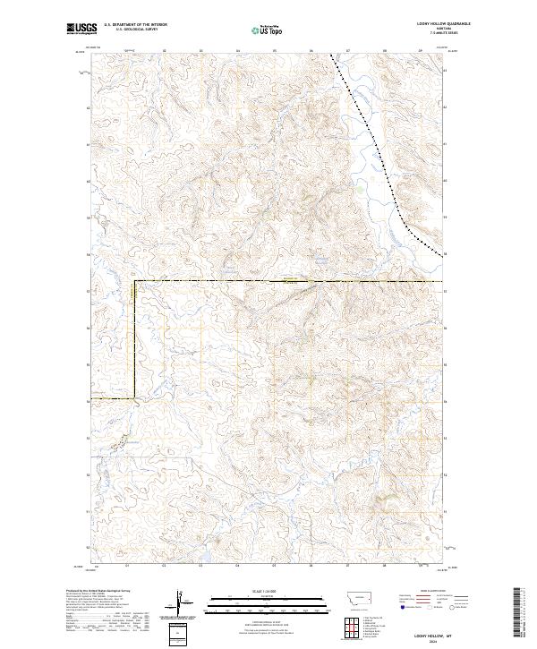
2024 Map of Loony Hollow
USGS Topo · Published 2024About this map
Loony Hollow cuts through the center of this terrain where the boundary between Prairie Co and Custer Co divides the landscape. The map reveals a remote ranching and grazing environment defined by intermittent drainages and isolated water management features like Horse Reservoir and Archdale Reservoir. These catchments, essential for livestock in this arid portion of eastern Montana, are fed by systems such as Whitney Creek and Ash Creek. The name Shoemaker appears as a key point of human presence in an otherwise sparsely populated area, while the larger drainage of O'Fallon Creek meanders through the northeast corner. This 2024 survey documents a landscape of high plains topography where the Public Land Survey System grid, including t10n r54e and t9n r54e, continues to provide the primary structure for land ownership and movement.
Find a feature on this map
13 named features on this map. Tap any name to fly to it.
Don’t see what you’re looking for? This feature index may not catch every label — zoom into the map to look around manually.
Map Details
Editions of this 2024 Loony Hollow Map
This is the sole edition of this map. No revisions or reprints were ever made.
Other maps of this area

1953 · Miles City
USGS Topo · 1:250,000

1957 · Miles City
USGS Topo · 1:250,000

1958 · Miles City
USGS Topo · 1:250,000

1969 · Little Whitney Creek
USGS Topo · 1:24,000

1969 · Montague Butte
USGS Topo · 1:24,000

1969 · Flat Top Butte NE
USGS Topo · 1:24,000

1980 · Terry
USGS Topo · 1:100,000
1980 · Miles City
USGS Topo · 1:100,000

1981 · Baker
USGS Topo · 1:100,000

1981 · Mildred NE
USGS Topo · 1:24,000