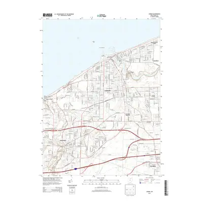
2013 Map of Lorain
USGS Topo · Published 2013About this map
Lorain and its neighboring communities are defined by their deep connection to the Lake Erie shoreline and the industrial corridor of the Black River. This 2013 survey illustrates the dense residential grid of Sheffield Lake and Amherst, interwoven with the heavy transit infrastructure of the Norfolk Southern railroad. Engineering landmarks like the Charles Berry Bascule Bridge and the Lofton Henderson Memorial Bridge facilitate movement across the river, connecting the downtown core with South Lorain. For those tracing family histories or land use, the map identifies numerous established grounds such as Elmwood Cem, Saint Marys Cem, and Mid Ridge Cem, alongside unique local features like the Spiegelberg Orchards and the Lorain Lighthouse standing watch at the harbor entrance.
Find a feature on this map
153 named features on this map. Tap any name to fly to it.
Don’t see what you’re looking for? This feature index may not catch every label — zoom into the map to look around manually.
Map Details
Editions of this 2013 Lorain Map
This is the sole edition of this map. No revisions or reprints were ever made.
Other maps of this area

1901 · Oberlin
USGS Topo · 1:62,500

1903 · Vermilion
USGS Topo · 1:62,500

1903 · Oberlin
USGS Topo · 1:62,500

1953 · Grafton
USGS Topo · 1:24,000

1953 · Avon
USGS Topo · 1:24,000

1956 · Toledo
USGS Topo · 1:250,000

1959 · Vermilion East
USGS Topo · 1:24,000

1959 · Kipton
USGS Topo · 1:24,000

1960 · Oberlin
USGS Topo · 1:24,000
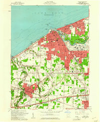
1960 · Lorain
USGS Topo · 1:24,000