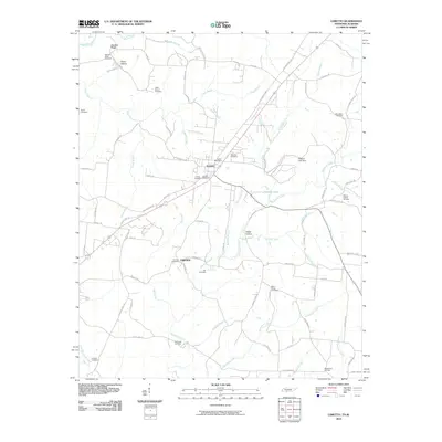
2010 Map of Loretto
USGS Topo · Published 2010About this map
Loretto stands as the central hub of this South Tennessee landscape, situated along the corridor of Old US Hwy 43. The map documents a community deeply rooted in its geography, evidenced by the high density of family and community burial sites such as Hensley Ridge Cemetery, Belew Springs Cemetery, and Saint Marys Cemetery. To the south, the settlement of Fairview marks the approach to the Alabama border, while the terrain transitions into several hollows and ridges, including Hensley Ridge and Fisher Hollow. The drainage of the area is defined by the winding paths of Bluewater Creek and Hurricane Creek, which are fed by numerous smaller tributaries like Williams Branch and Gable Branch. The Presence of Dickson Lake Dam and Johnson Lake illustrates the management of these local waters within a network of rural routes like Rascaltown Rd and Old Military Rd.
Find a feature on this map
86 named features on this map. Tap any name to fly to it.
Don’t see what you’re looking for? This feature index may not catch every label — zoom into the map to look around manually.
Map Details
Editions of this 2010 Loretto Map
This is the sole edition of this map. No revisions or reprints were ever made.
Other maps of this area

1905 · Waynesboro
USGS Topo · 1:125,000

1914 · Rogersville
USGS Topo · 1:48,000

1914 · Muscle Shoals
USGS Topo · 1:48,000

1916 · Muscle Shoals
USGS Topo · 1:62,500

1916 · Rogersville
USGS Topo · 1:62,500

1936 · Westpoint
USGS Topo · 1:24,000

1936 · Lexington
USGS Topo · 1:24,000

1936 · Lawrenceburg
USGS Topo · 1:24,000

1936 · Long Branch
USGS Topo · 1:24,000

1936 · Loretto
USGS Topo · 1:24,000