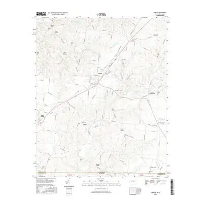
2016 Map of Loretto
USGS Topo · Published 2016About this map
Loretto serves as the central hub for this portion of Lawrence County, situated along the corridor between Tennessee and Alabama. The landscape is defined by a dense network of creek branches and hollows, where small settlements like Saint Joseph and Fairview are connected by rural routes such as Old Jackson Hwy. The distribution of family and community burial grounds, including Restview Cem and Hensley Ridge Cem, suggests a long-standing pattern of localized settlement in the uplands surrounding Bluewater Cr.
Find a feature on this map
134 named features on this map. Tap any name to fly to it.
Don’t see what you’re looking for? This feature index may not catch every label — zoom into the map to look around manually.
Map Details
Editions of this 2016 Loretto Map
This is the sole edition of this map. No revisions or reprints were ever made.
Other maps of this area

1905 · Waynesboro
USGS Topo · 1:125,000

1914 · Rogersville
USGS Topo · 1:48,000

1914 · Muscle Shoals
USGS Topo · 1:48,000

1916 · Muscle Shoals
USGS Topo · 1:62,500

1916 · Rogersville
USGS Topo · 1:62,500

1936 · Westpoint
USGS Topo · 1:24,000

1936 · Lexington
USGS Topo · 1:24,000

1936 · Lawrenceburg
USGS Topo · 1:24,000

1936 · Long Branch
USGS Topo · 1:24,000

1936 · Loretto
USGS Topo · 1:24,000