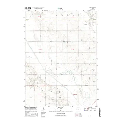
2015 Map of Loring
USGS Topo · Published 2015About this map
The South Skunk River meanders across the border of Story and Polk counties, defining the agricultural landscape of this central Iowa region. The small settlement of Loring is situated north of the river, surrounded by a dense grid of rural section roads and family-linked burial grounds. Genealogists can trace several significant sites including Peoria Cem, Mount Zion Cem, and United Brethren Cem, which serve as quiet markers of the area's early farming community. The map illustrates a complex hydrography where human engineering meets natural waterways, noted by the presence of Ditch Number 11 and Ditch Number 38 alongside the Old Channel. Near the southern edge, the terrain includes Woodland Lake and the Farrar Airport, showing the continued development of the land through the early 21st century while maintaining its foundational rural character.
Find a feature on this map
40 named features on this map. Tap any name to fly to it.
Don’t see what you’re looking for? This feature index may not catch every label — zoom into the map to look around manually.
Map Details
Editions of this 2015 Loring Map
This is the sole edition of this map. No revisions or reprints were ever made.
Other maps of this area

1905 · Des Moines
USGS Topo · 1:62,500

1907 · Des Moines
USGS Topo · 1:62,500

1911 · Slater
USGS Topo · 1:62,500

1913 · Slater
USGS Topo · 1:62,500

1930 · Mitchellville
USGS Topo · 1:62,500

1954 · Des Moines
USGS Topo · 1:250,000

1956 · Des Moines
USGS Topo · 1:250,000

1956 · Des Moines NE
USGS Topo · 1:24,000

1956 · Des Moines
USGS Topo · 1:62,500

1957 · Des Moines
USGS Topo · 1:250,000