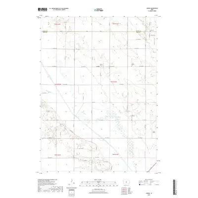
2018 Map of Loring
USGS Topo · Published 2018About this map
Loring sits at the heart of this agricultural landscape along the boundary of Story and Polk counties, a region defined by its grid of rural roads and the meandering path of the South Skunk River. This 2018 survey documents the systematic drainage of the Iowa prairie through features like Ditch Number 11 and Ditch Number 38, which support the intensive farming character of the area. For genealogists and local historians, the map is remarkably dense with burial sites, including Peoria Cem, Mount Zion Cem, and Holy Cross Cem, each anchoring long-established rural communities. The shifting hydrology of the valley is evident in the presence of Old Channel segments isolated from the current river flow. Near the eastern edge, the Farrar Airport provides a specialized landmark among the section lines and farmsteads.
Find a feature on this map
35 named features on this map. Tap any name to fly to it.
Don’t see what you’re looking for? This feature index may not catch every label — zoom into the map to look around manually.
Map Details
Editions of this 2018 Loring Map
This is the sole edition of this map. No revisions or reprints were ever made.
Other maps of this area

1905 · Des Moines
USGS Topo · 1:62,500

1907 · Des Moines
USGS Topo · 1:62,500

1911 · Slater
USGS Topo · 1:62,500

1913 · Slater
USGS Topo · 1:62,500

1930 · Mitchellville
USGS Topo · 1:62,500

1954 · Des Moines
USGS Topo · 1:250,000

1956 · Des Moines
USGS Topo · 1:250,000

1956 · Des Moines NE
USGS Topo · 1:24,000

1956 · Des Moines
USGS Topo · 1:62,500

1957 · Des Moines
USGS Topo · 1:250,000