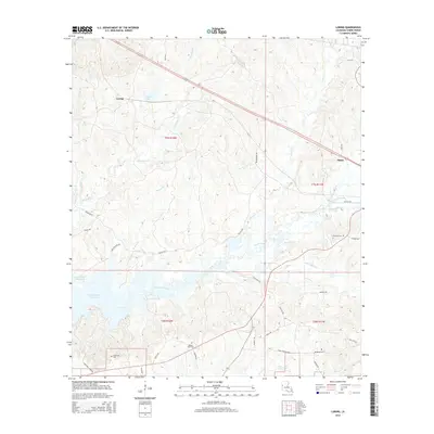
2015 Map of Loring
USGS Topo · Published 2015About this map
Toledo Bend Reservoir dominates the western edge of this Sabine Parish landscape, where the waters meet a complex network of drainages including Bayou La Nana and Negreet Creek. This modern survey documents the interface between the expanding reservoir and the traditional settlements of Loring and Many. The terrain is deeply inscribed with small-scale watercourses like Hurricane Creek and Edmondson Creek, which have historically shaped the rural road network and settlement patterns.
Find a feature on this map
39 named features on this map. Tap any name to fly to it.
Don’t see what you’re looking for? This feature index may not catch every label — zoom into the map to look around manually.
Map Details
Editions of this 2015 Loring Map
This is the sole edition of this map. No revisions or reprints were ever made.
Other maps of this area

1941 · Zwolle
USGS Topo · 1:62,500

1942 · Many
USGS Topo · 1:62,500

1942 · Florien
USGS Topo · 1:62,500

1943 · Many
USGS Topo · 1:62,500

1944 · Negreet
USGS Topo · 1:62,500

1944 · Florien
USGS Topo · 1:62,500

1944 · Zwolle
USGS Topo · 1:62,500

1953 · Alexandria
USGS Topo · 1:250,000

1954 · Florien
USGS Topo · 1:62,500
1954 · Florien
USGS Topo · 1:24,000