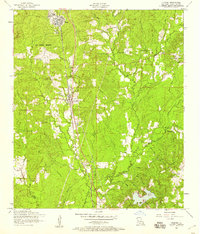
1954 Map of Florien
USGS Topo · Published 1958About this map
The Kansas City Southern railroad serves as the spine of this mid-1950s Sabine Parish landscape, connecting the lumber-rich timberlands from Fisher south through Florien. The topography is defined by the headwaters of Bayou Toro and Toro Creek, where a dense network of smaller drainages like Midkiff Creek and Tan Trough Creek carve through the piney woods. Evidence of earlier industrial footprints is visible in a dismantled railroad branching toward the northeast, likely a former logging spur serving the regional mills.
Find a feature on this map
41 named features on this map. Tap any name to fly to it.
Don’t see what you’re looking for? This feature index may not catch every label — zoom into the map to look around manually.
Map Details
Editions of this 1954 Florien Map
2 editions found
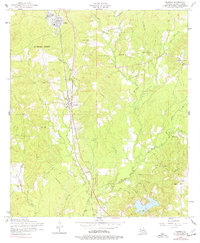
Other maps of this area

1941 · Zwolle
USGS Topo · 1:62,500

1942 · Many
USGS Topo · 1:62,500

1942 · Florien
USGS Topo · 1:62,500

1943 · Many
USGS Topo · 1:62,500

1944 · Negreet
USGS Topo · 1:62,500

1944 · Florien
USGS Topo · 1:62,500

1944 · Zwolle
USGS Topo · 1:62,500

1953 · Alexandria
USGS Topo · 1:250,000

1954 · Toro
USGS Topo · 1:24,000

1954 · Florien
USGS Topo · 1:62,500