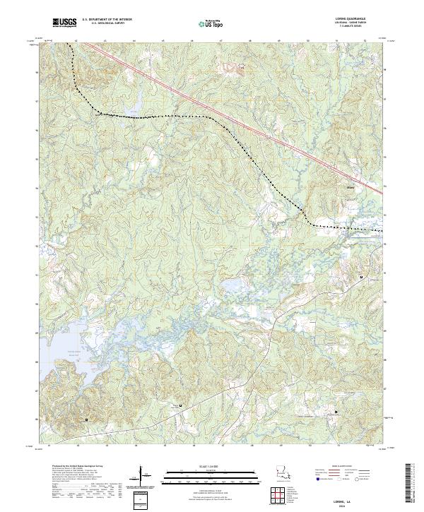
2024 Map of Loring
USGS Topo · Published 2024About this map
The waters of the Toledo Bend Reservoir dominate the western edge of this Sabine Parish landscape, reflecting the significant hydrological changes that have shaped the region. East of the reservoir, the terrain is characterized by a dense network of watercourses, including Bayou La Nana, Negreet Creek, and Edmondson Creek, which carve through the wooded elevations. The settlement of Loring is situated near Loring Lake, while the western outskirts of Many appear in the northeast, connected by a network of rural roads such as Mount Olive Rd and Shuteye Rd. Genealogy researchers will find several well-documented burial sites including Anderson Cem, Pilgrim Rest Cem, and Randolph Cem. The presence of Patterson Oil Field Rd hints at the local petroleum industry, while numerous small bayous like Harpoon Bayou and creeks like Hurricane Creek define the local drainage patterns typical of this Louisiana timber and bayou country.
Find a feature on this map
63 named features on this map. Tap any name to fly to it.
Don’t see what you’re looking for? This feature index may not catch every label — zoom into the map to look around manually.
Map Details
Editions of this 2024 Loring Map
This is the sole edition of this map. No revisions or reprints were ever made.
Other maps of this area

1941 · Zwolle
USGS Topo · 1:62,500

1942 · Many
USGS Topo · 1:62,500

1942 · Florien
USGS Topo · 1:62,500

1943 · Many
USGS Topo · 1:62,500

1944 · Negreet
USGS Topo · 1:62,500

1944 · Florien
USGS Topo · 1:62,500

1944 · Zwolle
USGS Topo · 1:62,500

1953 · Alexandria
USGS Topo · 1:250,000

1954 · Florien
USGS Topo · 1:62,500
1954 · Florien
USGS Topo · 1:24,000