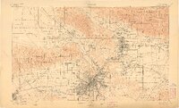
1900 Map of Los Angeles
USGS Topo · Published 1908About this map
Los Angeles and its emerging suburban rings are documented here during a period of rapid transition from vast ranchos to an interconnected urban grid. Large Spanish-era land grants like La Brea, Los Felis, and Rodeo de Las Aguas still define the property boundaries of the basin, while new settlements like Hollywood, Burbank, and Tropico take shape along the Southern Pacific R. R. and the Los Angeles Terminal R. R. lines. To the north, the San Gabriel Timber Land Reserve rises sharply above Pasadena, featuring early mountain tourism landmarks such as the Mt. Lowe Hotel and the incline at Echo Mountain. The map captures the region's complex water landscape before major modern engineering, showing the seasonal courses of the Los Angeles River, Ballona Creek, and numerous washes and canyons draining the Santa Monica Mountains toward the Pacific Ocean.
Find a feature on this map
162 named features on this map. Tap any name to fly to it.
Don’t see what you’re looking for? This feature index may not catch every label — zoom into the map to look around manually.
Map Details
Editions of this 1900 Los Angeles Map
4 editions found

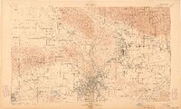
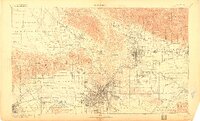
Other maps of this area

1894 · Los Angeles
USGS Topo · 1:62,500

1894 · Pomona
USGS Topo · 1:62,500

1896 · Pasadena
USGS Topo · 1:62,500

1896 · Anaheim
USGS Topo · 1:62,500

1896 · Redondo
USGS Topo · 1:62,500

1896 · Santa Monica
USGS Topo · 1:62,500

1896 · Downey
USGS Topo · 1:62,500

1897 · Pomona
USGS Topo · 1:62,500

1898 · Pomona
USGS Topo · 1:62,500

1898 · Santa Monica
USGS Topo · 1:62,500