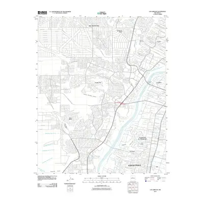
2010 Map of Los Griegos
USGS Topo · Published 2010About this map
The Rio Grande corridor north of Albuquerque reveals a complex landscape of riparian agriculture and modern residential expansion at the start of the twenty-first century. On the eastern banks, the map details an intricate network of irrigation systems including the Alameda Drain, Gallegos Lateral, and Chamizal Lateral, which historically supported fertile valley lands like those of Los Poblanos Ranch. These irrigation features provide a stark contrast to the West Mesa, where the terrain is dominated by arroyos and canyons such as Piedras Marcadas Canyon and Boca Negra Canyon. Substantial suburban growth is evident in communities like Paradise Hills, Taylor Ranch, and Rio Rancho Estates, while the Alameda Bridge serves as a critical link across the river. This survey captures the transition from traditional valley agricultural settlements like Los Griegos and Los Ranchos De Albuquerque to the sprawling developments of the modern metropolitan area.
Find a feature on this map
97 named features on this map. Tap any name to fly to it.
Don’t see what you’re looking for? This feature index may not catch every label — zoom into the map to look around manually.
Map Details
Editions of this 2010 Los Griegos Map
This is the sole edition of this map. No revisions or reprints were ever made.
Other maps of this area

1888 · Bernalillo
USGS Topo · 1:125,000

1889 · Albuquerque
USGS Topo · 1:125,000

1893 · Albuquerque
USGS Topo · 1:125,000

1934 · Alameda
USGS Topo · 1:24,000

1934 · West Albuquerque
USGS Topo · 1:24,000

1934 · Griegos
USGS Topo · 1:24,000

1934 · East Albuquerque
USGS Topo · 1:24,000

1938 · Albuquerque
USGS Topo · 1:62,500

1954 · Alameda
USGS Topo · 1:24,000

1954 · Volcano Ranch
USGS Topo · 1:24,000