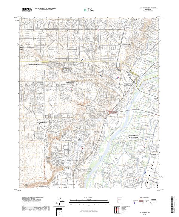
2023 Map of Los Griegos
USGS Topo · Published 2023About this map
The Petroglyph National Monument dominates the western volcanic escarpment in this contemporary survey, preserving thousands of ancestral carvings across canyons like Piedras Marcadas Canyon and Rinconada Canyon. This volcanic landscape transitions sharply into the densely settled Rio Grande valley, where ancient agricultural patterns persist through an extensive network of traditional irrigation channels including the Corrales Lateral and Griegos Drain. These watercourses reflect centuries of land management that still shape the boundaries of modern Albuquerque and Los Ranchos de Albuquerque.
Find a feature on this map
63 named features on this map. Tap any name to fly to it.
Don’t see what you’re looking for? This feature index may not catch every label — zoom into the map to look around manually.
Map Details
Editions of this 2023 Los Griegos Map
This is the sole edition of this map. No revisions or reprints were ever made.
Other maps of this area

1888 · Bernalillo
USGS Topo · 1:125,000

1889 · Albuquerque
USGS Topo · 1:125,000

1893 · Albuquerque
USGS Topo · 1:125,000

1934 · Alameda
USGS Topo · 1:24,000

1934 · West Albuquerque
USGS Topo · 1:24,000

1934 · Griegos
USGS Topo · 1:24,000

1934 · East Albuquerque
USGS Topo · 1:24,000

1938 · Albuquerque
USGS Topo · 1:62,500

1954 · Alameda
USGS Topo · 1:24,000

1954 · Volcano Ranch
USGS Topo · 1:24,000