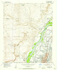
1954 Map of Los Griegos
USGS Topo · Published 1955About this map
The Rio Grande valley north of Albuquerque reveals an intricate network of irrigation and land grants during the mid-1950s. The landscape is defined by the sharp contrast between the arid high ground of the Town of Alameda Grant and the lush, irrigated floor of the Elena Gallegos Grant. A sophisticated water system, including the Albuquerque Main Canal and the Riverside Drain, supports local agriculture and large holdings like the Los Poblanos Ranch.
Find a feature on this map
51 named features on this map. Tap any name to fly to it.
Don’t see what you’re looking for? This feature index may not catch every label — zoom into the map to look around manually.
Map Details
Editions of this 1954 Los Griegos Map
This is the sole edition of this map. No revisions or reprints were ever made.
Other maps of this area

1888 · Bernalillo
USGS Topo · 1:125,000

1889 · Albuquerque
USGS Topo · 1:125,000

1893 · Albuquerque
USGS Topo · 1:125,000

1934 · Alameda
USGS Topo · 1:24,000

1934 · West Albuquerque
USGS Topo · 1:24,000

1934 · Griegos
USGS Topo · 1:24,000

1934 · East Albuquerque
USGS Topo · 1:24,000

1938 · Albuquerque
USGS Topo · 1:62,500

1954 · Alameda
USGS Topo · 1:24,000

1954 · Volcano Ranch
USGS Topo · 1:24,000