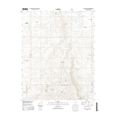
2013 Map of Los Indios Canyon
USGS Topo · Published 2013About this map
The Continental Divide crests through this high-altitude landscape of northern New Mexico, marking a significant hydrological and geographical boundary within Santa Fe National Forest. This 2013 survey reveals a terrain defined by deep drainages and isolated water sources essential for land management and local ranching. Notable features include Timber Lake and several man-made improvements such as Tapia Tank and Ojitos Tank, which support the region's livestock and wildlife.
Find a feature on this map
27 named features on this map. Tap any name to fly to it.
Don’t see what you’re looking for? This feature index may not catch every label — zoom into the map to look around manually.
Map Details
Editions of this 2013 Los Indios Canyon Map
This is the sole edition of this map. No revisions or reprints were ever made.
Other maps of this area

1889 · Largo
USGS Topo · 1:250,000

1895 · Largo
USGS Topo · 1:250,000

1909 · Gallina
USGS Topo · 1:125,000

1954 · Aztec
USGS Topo · 1:250,000

1955 · Llaves
USGS Topo · 1:62,500

1955 · Boulder Lake
USGS Topo · 1:62,500

1958 · Aztec
USGS Topo · 1:250,000

1962 · Aztec
USGS Topo · 1:250,000
1963 · Ojito
USGS Topo · 1:24,000
1963 · Cement Lake
USGS Topo · 1:24,000