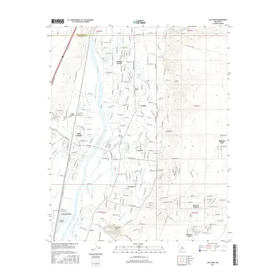
2017 Map of Los Lunas
USGS Topo · Published 2017About this map
Rio Grande waters dominate the center of this landscape, feeding an intricate network of irrigation and drainage infrastructure essential to the valley's agricultural character. This system includes the Upper Peralta Riverside Drain, Los Lunas Ditch, and the San Fernandez Drain, which crisscross the lowlands between Los Lunas and the higher desert terrain to the east. The map captures a high density of small, community-centered burial grounds and missions, such as the Spanish Methodist Cem and Sangre de Cristo Cem, which serve the settlements of Peralta and Valencia. To the east, the terrain rises toward the volcanic formation of El Cerro Tome, while modern developments like Monterey Park and the Mid Valley Airpark appear alongside established village cores, illustrating the region's continued growth within a traditional Rio Grande valley layout.
Find a feature on this map
151 named features on this map. Tap any name to fly to it.
Don’t see what you’re looking for? This feature index may not catch every label — zoom into the map to look around manually.
Map Details
Editions of this 2017 Los Lunas Map
This is the sole edition of this map. No revisions or reprints were ever made.
Other maps of this area

1952 · Wind Mesa
USGS Topo · 1:24,000

1952 · Dalies
USGS Topo · 1:24,000

1952 · Tome NE
USGS Topo · 1:24,000

1952 · Belen
USGS Topo · 1:24,000

1952 · Hubbell Spring
USGS Topo · 1:24,000

1952 · Tome
USGS Topo · 1:24,000

1952 · Los Lunas SE
USGS Topo · 1:24,000

1952 · Los Lunas
USGS Topo · 1:24,000

1952 · Isleta
USGS Topo · 1:24,000

1954 · Socorro
USGS Topo · 1:250,000