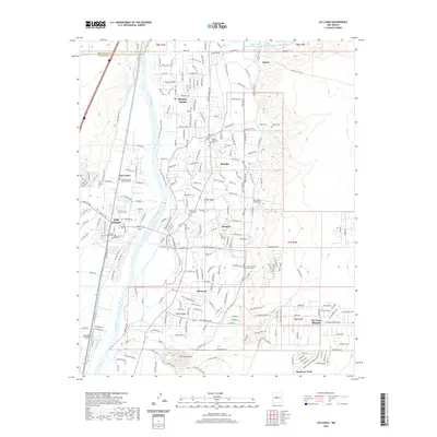
2020 Map of Los Lunas
USGS Topo · Published 2020About this map
Los Lunas and the fertile valley along the Rio Grande serve as the heart of this Valencia County landscape, illustrating a modern pattern of settlement that remains deeply rooted in its agricultural and tribal history. The map shows the transition from the river's floodplain to the rising terrain of El Cerro Tome and the surrounding mesas. In the northern reaches, numerous tribal roads such as Tribal RD 1 and Tribal RD 22 cross into the neighboring Bernalillo County, reflecting the area's indigenous geography.
Find a feature on this map
51 named features on this map. Tap any name to fly to it.
Don’t see what you’re looking for? This feature index may not catch every label — zoom into the map to look around manually.
Map Details
Editions of this 2020 Los Lunas Map
This is the sole edition of this map. No revisions or reprints were ever made.
Other maps of this area

1952 · Wind Mesa
USGS Topo · 1:24,000

1952 · Dalies
USGS Topo · 1:24,000

1952 · Tome NE
USGS Topo · 1:24,000

1952 · Belen
USGS Topo · 1:24,000

1952 · Hubbell Spring
USGS Topo · 1:24,000

1952 · Tome
USGS Topo · 1:24,000

1952 · Los Lunas SE
USGS Topo · 1:24,000

1952 · Los Lunas
USGS Topo · 1:24,000

1952 · Isleta
USGS Topo · 1:24,000

1954 · Socorro
USGS Topo · 1:250,000