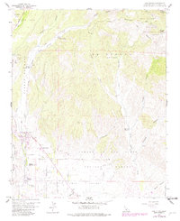
1959 Map of Los Olivos
USGS Topo · Published 1982About this map
Santa Ynez Valley ranching and small-town life define this transition from the valley floor into the southern reaches of the Los Padres National Forest. The settlement of Los Olivos sits at the junction of Foxen Canyon Road and the Figueroa Mountain Road, serving as a central hub for the surrounding College Rancho and nearby Ballard. The landscape is etched with complex drainage systems, including Alamo Pintado Creek and Zaca Creek, which flow south from the Solomon Hills and the rugged highlands of La Laguna (Gutierrez).
Find a feature on this map
37 named features on this map. Tap any name to fly to it.
Don’t see what you’re looking for? This feature index may not catch every label — zoom into the map to look around manually.
Map Details
Editions of this 1959 Los Olivos Map
3 editions found
Other maps of this area

1902 · Santa Ynez
USGS Topo · 1:125,000

1905 · Santa Ynez
USGS Topo · 1:125,000

1905 · Lompoc
USGS Topo · 1:125,000

1941 · San Rafael Mtn.
USGS Topo · 1:62,500

1941 · McPherson Peak
USGS Topo · 1:62,500

1942 · Lompoc
USGS Topo · 1:125,000

1942 · San Rafael Mtn.
USGS Topo · 1:62,500

1942 · Tepusquet Peak
USGS Topo · 1:62,500

1942 · Los Olivos
USGS Topo · 1:62,500

1943 · San Rafael Mtn.
USGS Topo · 1:62,500