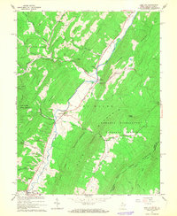
1966 Map of Lost City
USGS Topo · Published 1968About this map
South Fork Lost River and Little Lost River define the settlement patterns of this mid-1960s Appalachian landscape, where narrow valleys dictate the placement of roads and small communities. The map captures the tight-knit rural character of Hardy County, punctuated by numerous local congregations including Holly Hill Church, New Dale Ch, and Last River Ch. The terrain transitions from the protected lands of Lost River State Park and George Washington National Forest to active valley farming and resource extraction, evidenced by a Quarry and Gas Well near Big Ridge. In the southern portion of the quadrangle, Mathias serves as a small hub near the intersection of the river and several tributary hollows like Shoemaker Hollow and Strawderman Hollow. This survey preserves the exact locations of family-associated landmarks and small cemeteries such as Cedar Hill Cem, offering a detailed view of the region before modern infrastructure changes shifted these traditional mountain communities.
Find a feature on this map
46 named features on this map. Tap any name to fly to it.
Don’t see what you’re looking for? This feature index may not catch every label — zoom into the map to look around manually.
Map Details
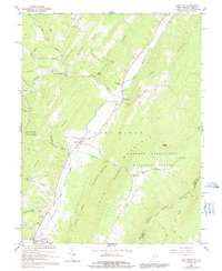
Editions of this 1966 Lost City Map
2 editions found
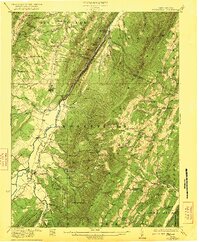
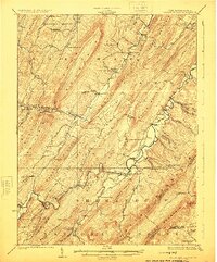
Other maps of this area

1891 · Romney
USGS Topo · 1:125,000

1892 · Woodstock
USGS Topo · 1:125,000

1920 · Moorefield
USGS Topo · 1:62,500

1921 · Orkney Springs
USGS Topo · 1:48,000

1921 · Moorefield
USGS Topo · 1:48,000
1922 · Moorefield
USGS Topo · 1:62,500

1922 · Wardensville
USGS Topo · 1:62,500

1923 · Orkney Springs
USGS Topo · 1:62,500

1923 · Edinburg
USGS Topo · 1:62,500
1924 · Wardensville
USGS Topo · 1:62,500