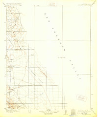
1914 Map of Lost Hills
USGS Topo · Published 1928About this map
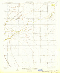
The Lost Hills and the expansive Antelope Plain define this early twentieth-century landscape on the western edge of the San Joaquin Valley. Surveyed between 1907 and 1908, the sheet captures the region just as oil exploration began to transform the area's arid character. Early infrastructure is sparse, marked primarily by isolated water sources like Alamo Solo Spr and the County Well, which were vital for cattle ranching and early travelers.
Find a feature on this map
21 named features on this map. Tap any name to fly to it.
Don’t see what you’re looking for? This feature index may not catch every label — zoom into the map to look around manually.
Map Details
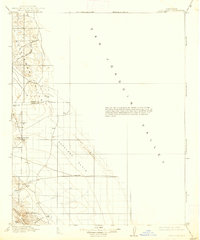
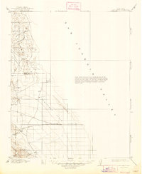
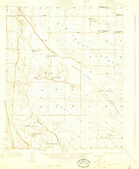
Editions of this 1914 Lost Hills Map
4 editions found
Other maps of this area

1910 · Buena Vista Lake
USGS Topo · 1:125,000

1912 · Coalinga
USGS Topo · 1:125,000

1912 · McKittrick
USGS Topo · 1:125,000

1912 · Buena Vista Lake
USGS Topo · 1:125,000

1914 · Lost Hills
USGS Topo · 1:125,000

1914 · Cholame
USGS Topo · 1:125,000

1915 · Cholame
USGS Topo · 1:125,000

1917 · Cholame
USGS Topo · 1:125,000
1927 · Semitropic
USGS Topo · 1:31,680
1927 · Lake View School
USGS Topo · 1:31,680