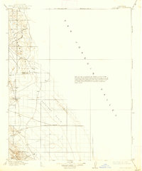
1914 Map of Lost Hills
USGS Topo · Published 1938About this map
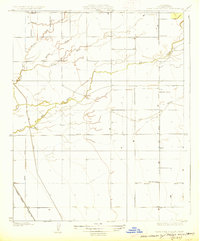
The San Joaquin Valley is defined here by its stark transition from the flat Antelope Plain to the prominent ridges of the Kettleman Hills. This 1914 survey, reprinted in 1938, documents a landscape where water was the primary concern for any inhabitant. Isolated water sources such as Alamo Solo Spr, Salt Spr, and the County Well are the only signs of infrastructure in an otherwise demanding environment.
Find a feature on this map
21 named features on this map. Tap any name to fly to it.
Don’t see what you’re looking for? This feature index may not catch every label — zoom into the map to look around manually.
Map Details
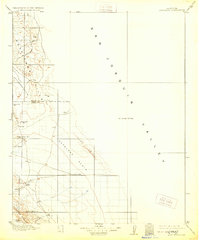
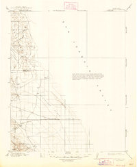
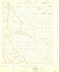
Editions of this 1914 Lost Hills Map
4 editions found
Other maps of this area

1910 · Buena Vista Lake
USGS Topo · 1:125,000

1912 · Coalinga
USGS Topo · 1:125,000

1912 · McKittrick
USGS Topo · 1:125,000

1912 · Buena Vista Lake
USGS Topo · 1:125,000

1914 · Lost Hills
USGS Topo · 1:125,000

1914 · Cholame
USGS Topo · 1:125,000

1915 · Cholame
USGS Topo · 1:125,000

1917 · Cholame
USGS Topo · 1:125,000
1927 · Semitropic
USGS Topo · 1:31,680
1927 · Lake View School
USGS Topo · 1:31,680