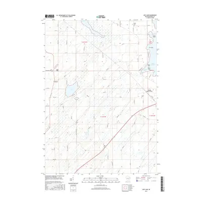
2015 Map of Lost Lake
USGS Topo · Published 2015About this map
Lost Lake serves as the central focal point for this Dodge County landscape, characterized by a complex network of wetlands and small water bodies. The settlement of Lost Lake sits at the western edge of its namesake water, providing a glimpse into the rural community structure of south-central Wisconsin in the early 21st century. The map reveals a land defined by agricultural parceling and the extensive National Wetlands Inventory, which highlights the preservation of local hydrography. The intricate drainage patterns and small islands within the lakes reflect a glacial topography that has historically dictated the placement of roads and homesteads across the region.
Find a feature on this map
1 named feature on this map. Tap any name to fly to it.
Don’t see what you’re looking for? This feature index may not catch every label — zoom into the map to look around manually.
Map Details
Editions of this 2015 Lost Lake Map
This is the sole edition of this map. No revisions or reprints were ever made.
Other maps of this area

1955 · Randolph
USGS Topo · 1:62,500

1955 · Columbus
USGS Topo · 1:62,500

1955 · Beaver Dam
USGS Topo · 1:62,500

1955 · Fox Lake
USGS Topo · 1:62,500

1957 · Madison
USGS Topo · 1:250,000

1960 · Madison
USGS Topo · 1:250,000

1975 · Beaver Dam NE
USGS Topo · 1:24,000

1980 · Fond Du Lac
USGS Topo · 1:100,000

1980 · Lost Lake
USGS Topo · 1:24,000
1980 · Columbus
USGS Topo · 1:24,000