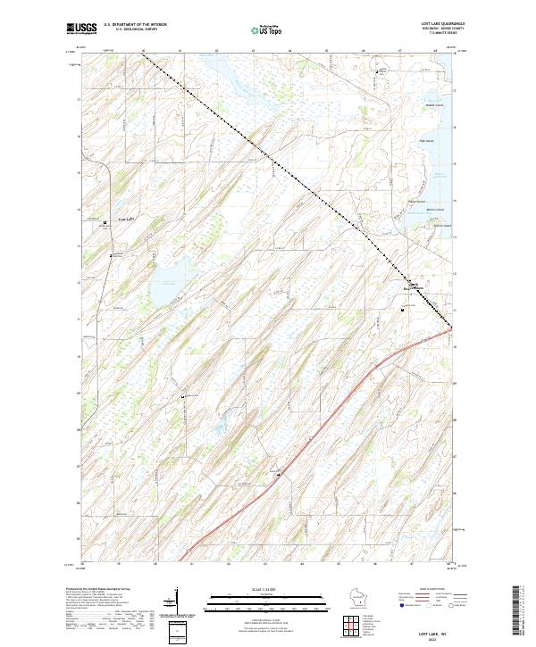
2022 Map of Lost Lake
USGS Topo · Published 2022About this map
The lowlands and wetlands of Dodge County define this landscape, where the Beaver Dam River and Lost Lake are central features in a largely agricultural region. The settlement of Lost Lake sits on the western edge of its namesake water body, while South Beaver Dam occupies the eastern portion of the sheet near the northern reaches of Calamus Cr. The map reveals a high concentration of burial sites reflecting the area's rural history, including English Prairie Cem, Annunciation Cem, and Wanderers Rest Cem.
Find a feature on this map
77 named features on this map. Tap any name to fly to it.
Don’t see what you’re looking for? This feature index may not catch every label — zoom into the map to look around manually.
Map Details
Editions of this 2022 Lost Lake Map
This is the sole edition of this map. No revisions or reprints were ever made.
Other maps of this area

1955 · Randolph
USGS Topo · 1:62,500

1955 · Columbus
USGS Topo · 1:62,500

1955 · Beaver Dam
USGS Topo · 1:62,500

1955 · Fox Lake
USGS Topo · 1:62,500

1957 · Madison
USGS Topo · 1:250,000

1960 · Madison
USGS Topo · 1:250,000

1975 · Beaver Dam NE
USGS Topo · 1:24,000

1980 · Fond Du Lac
USGS Topo · 1:100,000

1980 · Lost Lake
USGS Topo · 1:24,000
1980 · Columbus
USGS Topo · 1:24,000