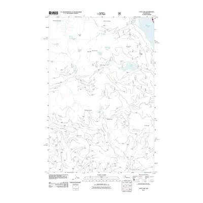
2011 Map of Lost Lake
USGS Topo · Published 2011About this map
Roaring Ridge Lookout stands watch over a complex network of high-elevation peaks and alpine basins in the Central Cascades. This 2011 survey documents the intricate drainage systems that feed the region’s waterways, including the headwaters of the North Fork Cedar River and the South Fork Cedar River. The landscape is defined by its prominent summits, such as Tinkham Peak and Silver Peak, which overlook numerous small lakes like Annette Lake and Mirror Lake.
Find a feature on this map
49 named features on this map. Tap any name to fly to it.
Don’t see what you’re looking for? This feature index may not catch every label — zoom into the map to look around manually.
Map Details
Editions of this 2011 Lost Lake Map
This is the sole edition of this map. No revisions or reprints were ever made.
Other maps of this area

1901 · Snoqualmie Pass
USGS Topo · 1:125,000

1903 · Snoqualmie
USGS Topo · 1:125,000

1913 · Cedar Lake
USGS Topo · 1:125,000

1956 · Greenwater
USGS Topo · 1:62,500

1957 · Wenatchee
USGS Topo · 1:250,000

1960 · Bandera
USGS Topo · 1:62,500

1961 · Snoqualmie Pass
USGS Topo · 1:62,500

1962 · Lester
USGS Topo · 1:62,500

1975 · Snoqualmie Pass
USGS Topo · 1:100,000
1986 · Nagrom
USGS Topo · 1:24,000