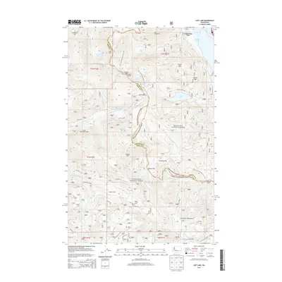
2014 Map of Lost Lake
USGS Topo · Published 2014About this map
Snoqualmie Pass and the surrounding high-country terrain of the Cascade Range are documented here along the divide between King and Kittitas counties. This landscape is defined by the headwaters of the N Fork Cedar River and S Fork Cedar River, protected within the restricted Cedar River Watershed. The high-elevation hydrology is characterized by numerous mountain basins containing Lost Lake, Mirror Lake, and Annette Lake, all linked by a complex network of forest roads and hiking paths.
Find a feature on this map
35 named features on this map. Tap any name to fly to it.
Don’t see what you’re looking for? This feature index may not catch every label — zoom into the map to look around manually.
Map Details
Editions of this 2014 Lost Lake Map
This is the sole edition of this map. No revisions or reprints were ever made.
Other maps of this area

1901 · Snoqualmie Pass
USGS Topo · 1:125,000

1903 · Snoqualmie
USGS Topo · 1:125,000

1913 · Cedar Lake
USGS Topo · 1:125,000

1956 · Greenwater
USGS Topo · 1:62,500

1957 · Wenatchee
USGS Topo · 1:250,000

1960 · Bandera
USGS Topo · 1:62,500

1961 · Snoqualmie Pass
USGS Topo · 1:62,500

1962 · Lester
USGS Topo · 1:62,500

1975 · Snoqualmie Pass
USGS Topo · 1:100,000
1986 · Nagrom
USGS Topo · 1:24,000