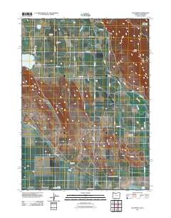
2011 Map of Lost River
USGS Topo · Published 2011About this map
The agricultural and hydrological landscape of southern Oregon is defined here by the winding course of the Lost River and an intricate network of irrigation systems, including the G Canal and North Canal. This 2011 survey captures a region where managed water sources like Dehlinger Reservoir and Spring Lake support the high-desert farming economy. Settled areas are sparse, represented by small locales like Hosley and Stukel, which sit in the shadow of prominent terrain such as Stukel Mountain and Manning Ridge. For genealogists and local historians, the map identifies significant burial sites including the Mount Laki Cemetery and the Independent Order of Odd Fellows Cemetery. These landmarks, along with infrastructure like the Stukel Bridge and the Long Ranch Airstrip, provide a clear picture of how transport and community life are organized around the constraints of the terrain and the vital flow of the local water system.
Find a feature on this map
36 named features on this map. Tap any name to fly to it.
Don’t see what you’re looking for? This feature index may not catch every label — zoom into the map to look around manually.
Map Details
Editions of this 2011 Lost River Map
This is the sole edition of this map. No revisions or reprints were ever made.
Other maps of this area

1886 · Modoc Lava Bed
USGS Topo · 1:250,000

1889 · Klamath
USGS Topo · 1:250,000

1892 · Modoc Lava-Bed
USGS Topo · 1:250,000

1894 · Klamath
USGS Topo · 1:250,000

1950 · Mt. Dome
USGS Topo · 1:62,500

1950 · Dorris
USGS Topo · 1:62,500

1954 · Alturas
USGS Topo · 1:250,000

1955 · Klamath Falls
USGS Topo · 1:250,000

1957 · Merrill
USGS Topo · 1:62,500

1957 · Klamath Falls
USGS Topo · 1:62,500