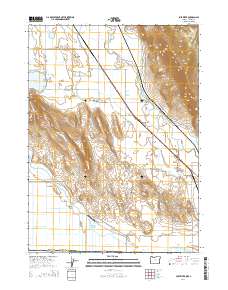
2014 Map of Lost River
USGS Topo · Published 2014About this map
The Lost River meanders through a landscape of irrigated valleys and prominent ridges along the Oregon and California border. This 2014 survey details the complex water management system of the region, featuring the G Canal and Dehlinger Reservoir which support the agricultural life in Spring Lake Valley. The terrain is defined by significant elevations such as Stukel Mtn and the Klamath Hills, while Manning Ridge and Mt Laki rise above the surrounding basin.
Find a feature on this map
43 named features on this map. Tap any name to fly to it.
Don’t see what you’re looking for? This feature index may not catch every label — zoom into the map to look around manually.
Map Details
Editions of this 2014 Lost River Map
This is the sole edition of this map. No revisions or reprints were ever made.
Other maps of this area

1886 · Modoc Lava Bed
USGS Topo · 1:250,000

1889 · Klamath
USGS Topo · 1:250,000

1892 · Modoc Lava-Bed
USGS Topo · 1:250,000

1894 · Klamath
USGS Topo · 1:250,000

1950 · Mt. Dome
USGS Topo · 1:62,500

1950 · Dorris
USGS Topo · 1:62,500

1954 · Alturas
USGS Topo · 1:250,000

1955 · Klamath Falls
USGS Topo · 1:250,000

1957 · Merrill
USGS Topo · 1:62,500

1957 · Klamath Falls
USGS Topo · 1:62,500