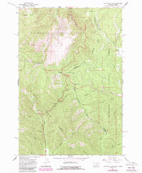
1966 Map of Lost Trail Pass
USGS Topo · Published 1989About this map
The Continental Divide winds through this high-altitude landscape along the border of Montana and Idaho, serving as the central spine for three distinct national forests. The 1966 data, updated in the 1980s, highlights the recreational and administrative infrastructure of the era, including the Sports Area and Ski Tow near Lost Trail Pass. This intersection of geography and utility is further evidenced by the Hogans Guard Sta and the Lookout Tower on Saddle Mtn, reflecting the U.S. Forest Service's active management of the Bitterroot National Forest, Beaverhead National Forest, and Salmon National Forest. Drainage patterns are clearly defined, with the North Fork Salmon River and West Fork Salmon River flowing south, while Camp Creek and its various forks head north toward the Bitterroot Valley.
Find a feature on this map
46 named features on this map. Tap any name to fly to it.
Don’t see what you’re looking for? This feature index may not catch every label — zoom into the map to look around manually.
Map Details
Editions of this 1966 Lost Trail Pass Map
3 editions found
Other maps of this area

1955 · Dillon
USGS Topo · 1:250,000

1956 · Elk City
USGS Topo · 1:250,000

1957 · Dillon
USGS Topo · 1:250,000

1958 · Dillon
USGS Topo · 1:250,000

1960 · Elk City
USGS Topo · 1:250,000

1960 · Piquett Mountain
USGS Topo · 1:62,500

1962 · Dillon
USGS Topo · 1:250,000

1965 · Dillon
USGS Topo · 1:250,000

1965 · Medicine Hot Springs
USGS Topo · 1:24,000

1966 · Lost Trail Pass
USGS Topo · 1:24,000