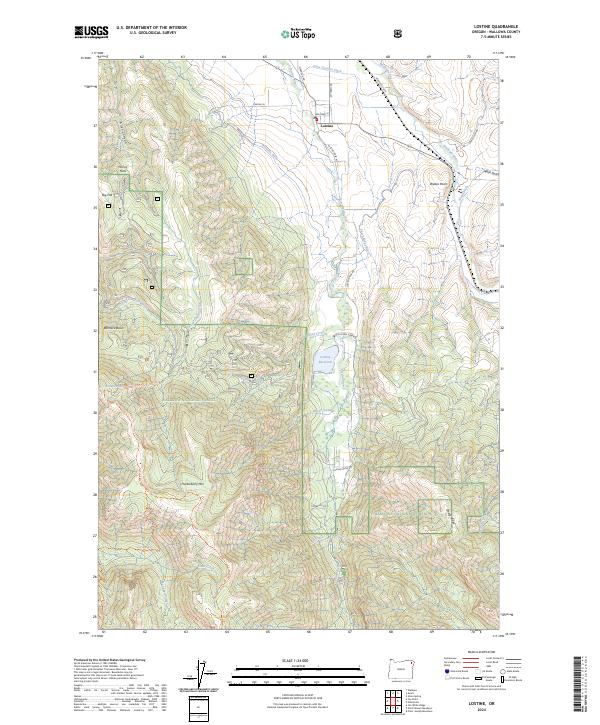
2024 Map of Lostine
USGS Topo · Published 2024About this map
Lostine serves as the focal point of this Wallowa County landscape, situated near the confluence of the Lostine River and the Wallowa River. The settlement pattern reflects a deeply integrated irrigation network, with named engineering like the Cross Country Ditch, Westside Ditch, and Sheep-Ridge Ditch branching across the valley floor to support local agriculture. The terrain shifts dramatically to the south and west, ascending into the Wallowa National Forest and the protected peaks of the Eagle Cap Wilderness.
Find a feature on this map
44 named features on this map. Tap any name to fly to it.
Don’t see what you’re looking for? This feature index may not catch every label — zoom into the map to look around manually.
Map Details
Editions of this 2024 Lostine Map
This is the sole edition of this map. No revisions or reprints were ever made.
Other maps of this area

1906 · Telocaset
USGS Topo · 1:125,000

1955 · Grangeville
USGS Topo · 1:250,000

1957 · Enterprise
USGS Topo · 1:62,500

1957 · Sled Springs
USGS Topo · 1:62,500

1959 · Grangeville
USGS Topo · 1:250,000

1964 · Wallowa
USGS Topo · 1:24,000

1965 · Fox Point
USGS Topo · 1:24,000
1966 · Jim White Ridge
USGS Topo · 1:24,000

1982 · Wallowa
USGS Topo · 1:100,000

1986 · Enterprise
USGS Topo · 1:100,000