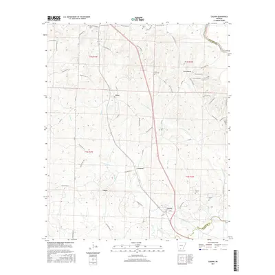
2017 Map of Louann
USGS Topo · Published 2017About this map
Louann and its surrounding timberlands and creek bottoms are documented here in the southern Arkansas lowlands. The landscape is defined by the drainage systems of the Ouachita River and Smackover Cr, where numerous small tributaries like Wolf Cr and N Fork Smackover Cr carve through the terrain. The map reveals a high density of small rural burial grounds, including Old Liberty Cem, Mount Horeb Cem, and Ebenezer Cem, which often represent the only remaining physical landmarks of early family homesteads in these wooded townships. Small community centers such as Elliott and Frenchport are connected by a web of county roads, including Ouachita Road 54 and Ouachita Road 2, reflecting the persistent rural settlement patterns of Ouachita County. The southern edge of the survey transitions across the Ouachita and Union County line, capturing the interface of these two South Arkansas districts.
Find a feature on this map
66 named features on this map. Tap any name to fly to it.
Don’t see what you’re looking for? This feature index may not catch every label — zoom into the map to look around manually.
Map Details
Editions of this 2017 Louann Map
This is the sole edition of this map. No revisions or reprints were ever made.
Other maps of this area

1903 · Camden
USGS Topo · 1:125,000

1951 · Camden
USGS Topo · 1:24,000

1953 · El Dorado
USGS Topo · 1:250,000

1957 · El Dorado
USGS Topo · 1:250,000

1958 · El Dorado
USGS Topo · 1:250,000

1960 · El Dorado
USGS Topo · 1:250,000

1962 · Lisbon
USGS Topo · 1:24,000

1962 · Louann
USGS Topo · 1:24,000

1962 · Buena Vista
USGS Topo · 1:24,000

1962 · Smackover
USGS Topo · 1:24,000