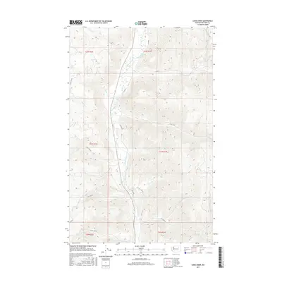
2017 Map of Louie Creek
USGS Topo · Published 2017About this map
The Sanpoil River valley dominates this portion of Ferry County, serving as the central drainage for a network of tributaries that carve through the high terrain. In this 2017 study, the landscape is defined by the convergence of several major creeks, including Bridge Creek and Copoose Creek from the west and Louie Creek from the east. The map illustrates a contemporary rural infrastructure where Bureau of Indian Affairs routes and county highways provide access to these waterways. Roads like Lime Creek Rd and Iron Creek Rd follow the natural contours of the land, tracing the paths of Lime Creek and Iron Creek respectively. The prominence of these watercourse-aligned routes suggests a landscape where movement and settlement remain closely tied to the primary river valley and its feeders, such as Forty Mile Creek and McAllister Creek.
Find a feature on this map
26 named features on this map. Tap any name to fly to it.
Don’t see what you’re looking for? This feature index may not catch every label — zoom into the map to look around manually.
Map Details
Editions of this 2017 Louie Creek Map
This is the sole edition of this map. No revisions or reprints were ever made.
Other maps of this area

1950 · Nespelem
USGS Topo · 1:62,500

1952 · Keller
USGS Topo · 1:62,500

1953 · Seventeenmile Mtn.
USGS Topo · 1:62,500

1953 · Bald Knob
USGS Topo · 1:62,500

1954 · Okanogan
USGS Topo · 1:250,000

1958 · Okanogan
USGS Topo · 1:250,000

1984 · Nespelem
USGS Topo · 1:100,000

1986 · Central Peak
USGS Topo · 1:24,000
1989 · Keller
USGS Topo · 1:24,000
1989 · Nespelem NE
USGS Topo · 1:24,000