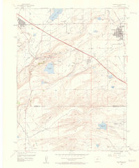
1957 Map of Louisville
USGS Topo · Published 1960About this map
The coal-mining heritage of the northern Colorado Front Range is clearly visible here, particularly around the settlement of Marshall. This landscape is defined by its complex irrigation and industrial history, featuring an extensive network of ditches like the Community Ditch and Davidson Ditch alongside dozens of named mining operations. In the late 1950s, the Denver Boulder Turnpike serves as a modern corridor through the undulating terrain of Davidson Mesa, while the Colorado and Southern railroad tracks connect the industrial pits and shafts to the growing towns. To the south, the open expanse of Rocky Flats borders the headwaters of Woman Creek and Walnut Creek, while Louisville and the eastern edge of Boulder show their mid-century footprints, complete with local institutions like Sacred Heart Ch and Martin Park Sch.
Find a feature on this map
63 named features on this map. Tap any name to fly to it.
Don’t see what you’re looking for? This feature index may not catch every label — zoom into the map to look around manually.
Map Details
Editions of this 1957 Louisville Map
2 editions found
Other maps of this area

1899 · West Denver
USGS Topo · 1:125,000

1902 · Boulder
USGS Topo · 1:62,500

1904 · Niwot
USGS Topo · 1:62,500

1904 · Boulder
USGS Topo · 1:62,500

1906 · Blackhawk
USGS Topo · 1:62,500

1939 · Golden
USGS Topo · 1:24,000

1940 · Lafayette
USGS Topo · 1:31,680

1941 · Arvada
USGS Topo · 1:31,680

1942 · Eldorado Springs
USGS Topo · 1:24,000

1942 · Golden
USGS Topo · 1:31,680