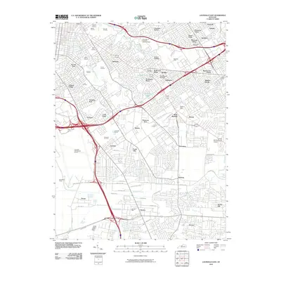
2010 Map of Louisville East
USGS Topo · Published 2010About this map
Cave Hill National Cemetery and its adjacent Cave Hill Cemetery anchor the northern reaches of this metropolitan landscape, representing a significant historical and genealogical landmark in the Highlands area. The 2010 geography is defined by a dense network of suburban cities and established neighborhoods, including Audubon Park, Seneca Gardens, and the enclave of Strathmoor Village. This era shows the mature development of the region's transportation infrastructure, dominated by the massive interchange near Prestonia and the expansive grounds of the Louisville International Airport.
Find a feature on this map
97 named features on this map. Tap any name to fly to it.
Don’t see what you’re looking for? This feature index may not catch every label — zoom into the map to look around manually.
Map Details
Editions of this 2010 Louisville East Map
This is the sole edition of this map. No revisions or reprints were ever made.
Other maps of this area

1905 · Prospect
USGS Topo · 1:62,500

1907 · Louisville
USGS Topo · 1:62,500

1909 · Kosmosdale
USGS Topo · 1:48,000

1912 · Prospect
USGS Topo · 1:62,500

1912 · Kosmosdale
USGS Topo · 1:62,500

1937 · Jeffersonville
USGS Topo · 1:24,000

1939 · New Albany
USGS Topo · 1:24,000

1946 · Jeffersonville
USGS Topo · 1:24,000

1946 · New Albany
USGS Topo · 1:24,000
1950 · New Albany
USGS Topo · 1:24,000