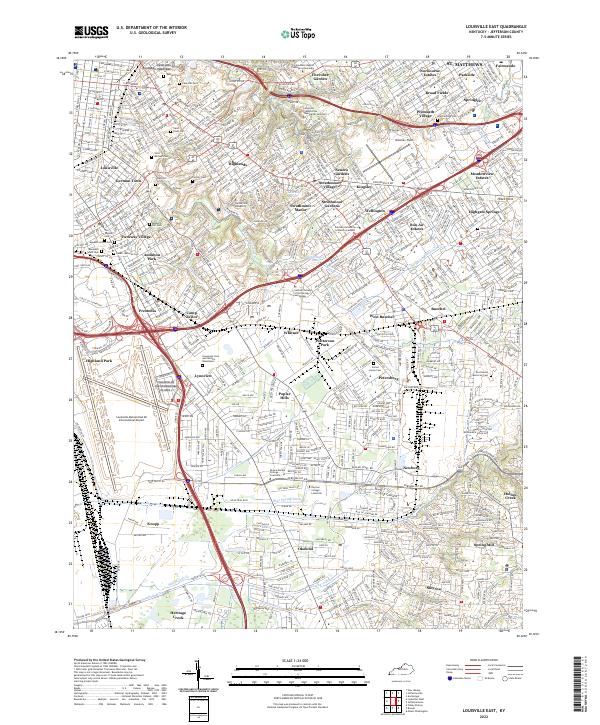
2022 Map of Louisville East
USGS Topo · Published 2022About this map
Louisville and its eastern suburbs are detailed in this modern survey, revealing the dense network of residential communities and major institutions that define Jefferson County. The map highlights significant religious and educational anchors including The Southern Baptist Theological Seminary and Louisville Presbyterian Theological Seminary, alongside Bellarmine University. A deep history of the city's growth is visible through its extensive cemeteries, from the expansive Cave Hill Cemetery to the Evergreen Cemetery and Garden Mausoleum.
Find a feature on this map
77 named features on this map. Tap any name to fly to it.
Don’t see what you’re looking for? This feature index may not catch every label — zoom into the map to look around manually.
Map Details
Editions of this 2022 Louisville East Map
This is the sole edition of this map. No revisions or reprints were ever made.
Other maps of this area

1905 · Prospect
USGS Topo · 1:62,500

1907 · Louisville
USGS Topo · 1:62,500

1909 · Kosmosdale
USGS Topo · 1:48,000

1912 · Prospect
USGS Topo · 1:62,500

1912 · Kosmosdale
USGS Topo · 1:62,500

1937 · Jeffersonville
USGS Topo · 1:24,000

1939 · New Albany
USGS Topo · 1:24,000

1946 · Jeffersonville
USGS Topo · 1:24,000

1946 · New Albany
USGS Topo · 1:24,000
1950 · New Albany
USGS Topo · 1:24,000