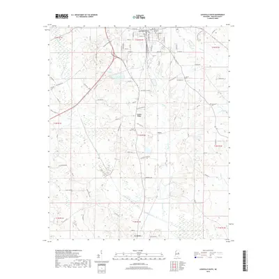
2018 Map of Louisville South
USGS Topo · Published 2018About this map
Louisville serves as the northern anchor of this landscape, where the street grid of the county seat transitions into the timberlands and creek bottoms of southern Winston County. The terrain is defined by the drainage of Tallabaga Creek and its many tributaries, including Reedy Cr, Hughes Cr, and Town Cr. Settlement patterns follow the ridgelines between these waterways, notably at Center Ridge and the small community of Estes. Historically significant sites for genealogists include several established burial grounds such as Flower Ridge Cem, Johnson Cem, and the Masonic Cem near the town center. The presence of Lake Tiak-O'Khata provides a prominent water feature amidst a network of rural routes like Old Robinson Rd and Smyth Lake Rd. To the south, the village of Noxapater marks the lower boundary of the survey, connected to the north by a dense system of secondary roads and local connectors.
Find a feature on this map
74 named features on this map. Tap any name to fly to it.
Don’t see what you’re looking for? This feature index may not catch every label — zoom into the map to look around manually.
Map Details
Editions of this 2018 Louisville South Map
This is the sole edition of this map. No revisions or reprints were ever made.
Other maps of this area

1953 · Meridian
USGS Topo · 1:250,000

1953 · West Point
USGS Topo · 1:250,000

1957 · Meridian
USGS Topo · 1:250,000

1958 · West Point
USGS Topo · 1:250,000

1962 · Vernon
USGS Topo · 1:24,000

1963 · West Point
USGS Topo · 1:250,000

1965 · Meridian
USGS Topo · 1:250,000

1972 · Louisville North
USGS Topo · 1:24,000

1972 · Highpoint
USGS Topo · 1:24,000

1972 · Plattsburg
USGS Topo · 1:24,000