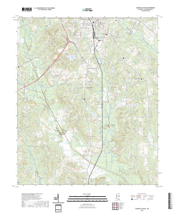
2024 Map of Louisville South
USGS Topo · Published 2024About this map
Louisville serves as the focal point of this Winston County survey, where the town's southern residential and industrial layout meets the surrounding timberlands and creek bottoms. The landscape is defined by the winding paths of Hughes Creek and the broader Tallahaga Creek drainage system, which influences the local road network and topography. To the south, the smaller communities of Center Ridge and Estes are mapped along a series of local connectors like Sylvester Hudson Rd and Estes Weeks Rd.
Find a feature on this map
71 named features on this map. Tap any name to fly to it.
Don’t see what you’re looking for? This feature index may not catch every label — zoom into the map to look around manually.
Map Details
Editions of this 2024 Louisville South Map
This is the sole edition of this map. No revisions or reprints were ever made.
Other maps of this area

1953 · Meridian
USGS Topo · 1:250,000

1953 · West Point
USGS Topo · 1:250,000

1957 · Meridian
USGS Topo · 1:250,000

1958 · West Point
USGS Topo · 1:250,000

1962 · Vernon
USGS Topo · 1:24,000

1963 · West Point
USGS Topo · 1:250,000

1965 · Meridian
USGS Topo · 1:250,000

1972 · Louisville North
USGS Topo · 1:24,000

1972 · Highpoint
USGS Topo · 1:24,000

1972 · Plattsburg
USGS Topo · 1:24,000