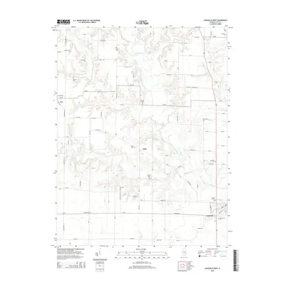
2015 Map of Louisville West
USGS Topo · Published 2015About this map
The Little Wabash River meanders through the heart of western Clay County, defining a landscape of agricultural lowlands and wooded creek bottoms. In this rural Illinois terrain, small communities like Iola, Riffle, and Little Prairie are connected by a grid of farm-to-market roads, while the outskirts of Louisville appear in the southeast corner. The density of small family and community burial grounds provides a detailed record for genealogical research, with sites such as the Newton Chapel Cem and Christian Home Cem serving as focal points for local history. Several tributaries, including Dismal Cr and Crooked Cr, feed into the river system, creating the drainage patterns that have shaped land use in the township for generations. The map's layout of section roads and property lines reflects the enduring rural character of this part of the Illinois Wabash Valley.
Find a feature on this map
86 named features on this map. Tap any name to fly to it.
Don’t see what you’re looking for? This feature index may not catch every label — zoom into the map to look around manually.
Map Details
Editions of this 2015 Louisville West Map
This is the sole edition of this map. No revisions or reprints were ever made.
Other maps of this area

1948 · Flora
USGS Topo · 1:62,500

1949 · Flora
USGS Topo · 1:62,500

1952 · Xenia
USGS Topo · 1:62,500

1953 · Sailor Springs
USGS Topo · 1:62,500

1956 · Edgewood
USGS Topo · 1:62,500

1958 · Belleville
USGS Topo · 1:250,000

1962 · Belleville
USGS Topo · 1:250,000
1968 · Xenia
USGS Topo · 1:24,000
1968 · Xenia NE
USGS Topo · 1:24,000
1970 · Flora
USGS Topo · 1:24,000