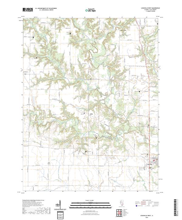
2024 Map of Louisville West
USGS Topo · Published 2024About this map
The Little Wabash River meanders across this landscape of rural Clay County, defining a terrain where small agricultural settlements and family-named landmarks predominate. In the southeast corner, the town of Louisville serves as a focal point, anchored by the Clay County Courthouse and historical burial sites like the Old Louisville Cem. The survey reveals a high density of small cemeteries scattered throughout the countryside, such as Speaks Cem and Riffle Cem, which often represent the remaining footprints of early family homesteads and pioneer communities. To the west, the settlements of Iola and Little Prairie sit near the headwaters of Dismal Creek and Crooked Creek, illustrating the classic Midwestern pattern of small-scale villages connected by a network of county roads following the township and section lines of the Public Land Survey System.
Find a feature on this map
90 named features on this map. Tap any name to fly to it.
Don’t see what you’re looking for? This feature index may not catch every label — zoom into the map to look around manually.
Map Details
Editions of this 2024 Louisville West Map
This is the sole edition of this map. No revisions or reprints were ever made.
Other maps of this area

1948 · Flora
USGS Topo · 1:62,500

1949 · Flora
USGS Topo · 1:62,500

1952 · Xenia
USGS Topo · 1:62,500

1953 · Sailor Springs
USGS Topo · 1:62,500

1956 · Edgewood
USGS Topo · 1:62,500

1958 · Belleville
USGS Topo · 1:250,000

1962 · Belleville
USGS Topo · 1:250,000
1968 · Xenia
USGS Topo · 1:24,000
1968 · Xenia NE
USGS Topo · 1:24,000
1970 · Flora
USGS Topo · 1:24,000