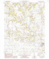
1985 Map of Louisville West
USGS Topo · Published 1985About this map
The Little Wabash River defines the central topography of this section of Clay County, joined by numerous tributaries including Dismal Creek, Crooked Creek, and Second Creek. The landscape transition from the river bottomlands to the surrounding prairie is marked by the presence of the Louisville (Louis Sta) settlement and the small community of Riffle. This mid-1980s data reflects a rural environment intertwined with modern utilities and industry, evidenced by a Double Wooden Pole Power Line, a Pipeline, and localized industrial sites like a Quarry and Gravel Pit.
Find a feature on this map
23 named features on this map. Tap any name to fly to it.
Don’t see what you’re looking for? This feature index may not catch every label — zoom into the map to look around manually.
Map Details
Editions of this 1985 Louisville West Map
This is the sole edition of this map. No revisions or reprints were ever made.
Other maps of this area

1948 · Flora
USGS Topo · 1:62,500

1949 · Flora
USGS Topo · 1:62,500

1952 · Xenia
USGS Topo · 1:62,500

1953 · Sailor Springs
USGS Topo · 1:62,500

1956 · Edgewood
USGS Topo · 1:62,500

1958 · Belleville
USGS Topo · 1:250,000

1962 · Belleville
USGS Topo · 1:250,000
1968 · Xenia
USGS Topo · 1:24,000
1968 · Xenia NE
USGS Topo · 1:24,000
1970 · Flora
USGS Topo · 1:24,000