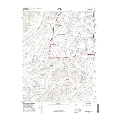
2016 Map of Louisville West
USGS Topo · Published 2016About this map
Louisville is shown here at its western and southern extents, where the city's urban grid meets the industrial and residential corridors of south Jefferson County. The landscape is defined by the heavy rail infrastructure of the Kentucky & Indiana Terminal RR and a sequence of established neighborhoods including Parkland, Shively, and South Parkland. These areas are densely packed with local history markers, from the grounds of the Univ of Louisville to numerous commemorative sites such as Greenwood Cem and Saint Stephens Cem.
Find a feature on this map
78 named features on this map. Tap any name to fly to it.
Don’t see what you’re looking for? This feature index may not catch every label — zoom into the map to look around manually.
Map Details
Editions of this 2016 Louisville West Map
This is the sole edition of this map. No revisions or reprints were ever made.
Other maps of this area

1905 · Prospect
USGS Topo · 1:62,500

1907 · Louisville
USGS Topo · 1:62,500

1909 · Kosmosdale
USGS Topo · 1:48,000

1912 · Prospect
USGS Topo · 1:62,500

1912 · Kosmosdale
USGS Topo · 1:62,500

1937 · Jeffersonville
USGS Topo · 1:24,000

1939 · New Albany
USGS Topo · 1:24,000

1939 · Georgetown
USGS Topo · 1:24,000

1946 · Jeffersonville
USGS Topo · 1:24,000

1946 · New Albany
USGS Topo · 1:24,000