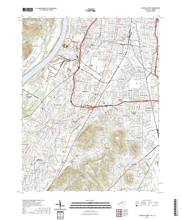
2022 Map of Louisville West
USGS Topo · Published 2022About this map
The Ohio River forms a natural western boundary for this urban landscape, where the industrial and residential developments of Louisville meet the rolling topography of Jefferson Co. This survey illustrates the dense neighborhood structures of Parkland, Shively, and Pleasure Ridge Park, alongside major educational institutions like the University of Louisville. The map reveals a complex web of transport and industry, from the Kentucky & Indiana Terminal RR to the drainage networks of Paddy Run and the Southern Ditch. For local historians and genealogists, the map is remarkably dense with burial grounds, including the large Greenwood Cem and Louisville Memorial Park, as well as smaller, family-associated sites such as the Prince Family Cem and Farnsley Cem. These landmarks, along with many smaller residential subdivisions like Jacobs Addition and Hunters Trace, provide a high-resolution look at the city’s southern and western expansion.
Find a feature on this map
269 named features on this map. Tap any name to fly to it.
Don’t see what you’re looking for? This feature index may not catch every label — zoom into the map to look around manually.
Map Details
Editions of this 2022 Louisville West Map
This is the sole edition of this map. No revisions or reprints were ever made.
Other maps of this area

1905 · Prospect
USGS Topo · 1:62,500

1907 · Louisville
USGS Topo · 1:62,500

1909 · Kosmosdale
USGS Topo · 1:48,000

1912 · Prospect
USGS Topo · 1:62,500

1912 · Kosmosdale
USGS Topo · 1:62,500

1937 · Jeffersonville
USGS Topo · 1:24,000

1939 · New Albany
USGS Topo · 1:24,000

1939 · Georgetown
USGS Topo · 1:24,000

1946 · Jeffersonville
USGS Topo · 1:24,000

1946 · New Albany
USGS Topo · 1:24,000