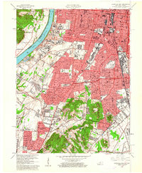
1960 Map of Louisville West
USGS Topo · Published 1961About this map
The Ohio River forms a sharp boundary between the industrial and residential corridors of Louisville and the wooded terrain of the New Albany Hills in this 1960 revision. The map documents a period of significant urban growth, with the emerging paths of the Watterson Expressway and Kentucky Turnpike beginning to reshape the suburban landscape near Shively and Pleasure Ridge Park. Major landmarks of mid-century infrastructure and social history are prominent, including the sprawling U S Naval Ordnance Plant and the Hazelwood Sanatorium.
Find a feature on this map
102 named features on this map. Tap any name to fly to it.
Don’t see what you’re looking for? This feature index may not catch every label — zoom into the map to look around manually.
Map Details
Editions of this 1960 Louisville West Map
This is the sole edition of this map. No revisions or reprints were ever made.
Other maps of this area

1905 · Prospect
USGS Topo · 1:62,500

1907 · Louisville
USGS Topo · 1:62,500

1909 · Kosmosdale
USGS Topo · 1:48,000

1912 · Prospect
USGS Topo · 1:62,500

1912 · Kosmosdale
USGS Topo · 1:62,500

1937 · Jeffersonville
USGS Topo · 1:24,000

1939 · New Albany
USGS Topo · 1:24,000

1939 · Georgetown
USGS Topo · 1:24,000

1946 · Jeffersonville
USGS Topo · 1:24,000

1946 · New Albany
USGS Topo · 1:24,000