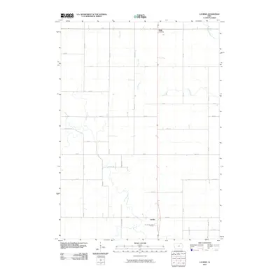
2010 Map of Lourdes
USGS Topo · Published 2010About this map
Turkey River and its West Branch Turkey River snake through this section of Howard County, defining a landscape of agricultural plots and rural road grids. The settlement of Lourdes serves as a local focal point near the southern edge of the sheet, anchored by the Our Lady of Lourdes Cemetery. This area reflects the mid-continental township-and-range surveying system, where roads like Lourdes Rd and Kent Ave follow section lines to connect isolated farmsteads and small communities. To the north, Davis Corners marks a key intersection along the primary thoroughfare. The map captures the quiet, persistent geometry of Iowa’s farming country, where nearly every mile is accounted for by a named road or a stream drainage, illustrating the organized settlement pattern of the early twenty-first century.
Find a feature on this map
27 named features on this map. Tap any name to fly to it.
Don’t see what you’re looking for? This feature index may not catch every label — zoom into the map to look around manually.
Map Details
Editions of this 2010 Lourdes Map
This is the sole edition of this map. No revisions or reprints were ever made.
Other maps of this area

1954 · Mason City
USGS Topo · 1:250,000

1957 · Mason City
USGS Topo · 1:250,000

1958 · Mason City
USGS Topo · 1:250,000

1972 · Elma
USGS Topo · 1:24,000

1972 · Jerico
USGS Topo · 1:24,000

1981 · Lourdes
USGS Topo · 1:24,000

1981 · Cresco NW
USGS Topo · 1:24,000

1981 · Lime Springs
USGS Topo · 1:24,000
1981 · Saude
USGS Topo · 1:24,000
1981 · Cresco SW
USGS Topo · 1:24,000