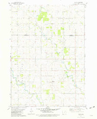
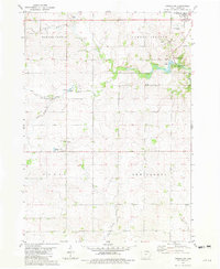
1981 Map of Saude
USGS Topo · Published 1982About this map
The Little Turkey River meanders across the rural landscape of Northeast Iowa, anchoring a region defined by scattered agricultural settlements and small country parishes during the early 1980s. The village of Saude sits at the heart of this survey, accompanied by Saude Park and the nearby Saude Ch. To the south, the community of Reilly Settlement is centered around Sacred Heart Ch, illustrating the tight-knit ecclesiastical social structure of the era. The terrain is further marked by legacy landmarks such as Yankee Cem and Bethany Hall, alongside smaller watercourses like Jackson Creek. This map captures a moment when traditional land divisions were still clearly visible, with fine red lines indicating the fence and field boundaries that partitioned the fertile fields of Howard and Chickasaw counties.
Find a feature on this map
17 named features on this map. Tap any name to fly to it.
Don’t see what you’re looking for? This feature index may not catch every label — zoom into the map to look around manually.
Map Details
Editions of this 1981 Saude Map
This is the sole edition of this map. No revisions or reprints were ever made.
Other maps of this area

1954 · Mason City
USGS Topo · 1:250,000

1957 · Mason City
USGS Topo · 1:250,000

1958 · Mason City
USGS Topo · 1:250,000

1972 · Jerico
USGS Topo · 1:24,000
1972 · New Hampton
USGS Topo · 1:24,000

1981 · Lourdes
USGS Topo · 1:24,000
1981 · Lawler
USGS Topo · 1:24,000
1981 · Cresco SE
USGS Topo · 1:24,000
1981 · Cresco SW
USGS Topo · 1:24,000
1981 · Waucoma
USGS Topo · 1:24,000