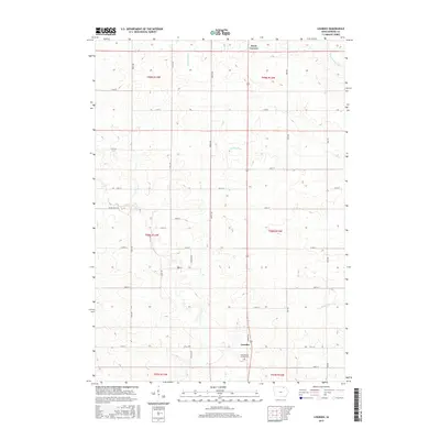
2015 Map of Lourdes
USGS Topo · Published 2015About this map
Lourdes and Davis Corners anchor this rural landscape in Howard County, where the upper reaches of the Turkey River system carve through the Iowa prairie. The map documents a highly structured agricultural grid defined by long-established section lines and township boundaries, including t99n r13w and t98n r12w. For those tracing local heritage, Our Lady of Lourdes Cem serves as a significant landmark at the southern end of the sheet, situated near the intersection of Lourdes Rd and 175th St. The drainage patterns are clearly defined by the W Br Turkey River in the northeast and the S Br Turkey River in the southeast, illustrating how the natural hydrology interacts with the strict geometric layout of county roads like Kent Ave and March Ave.
Find a feature on this map
35 named features on this map. Tap any name to fly to it.
Don’t see what you’re looking for? This feature index may not catch every label — zoom into the map to look around manually.
Map Details
Editions of this 2015 Lourdes Map
This is the sole edition of this map. No revisions or reprints were ever made.
Other maps of this area

1954 · Mason City
USGS Topo · 1:250,000

1957 · Mason City
USGS Topo · 1:250,000

1958 · Mason City
USGS Topo · 1:250,000

1972 · Elma
USGS Topo · 1:24,000

1972 · Jerico
USGS Topo · 1:24,000

1981 · Lourdes
USGS Topo · 1:24,000

1981 · Cresco NW
USGS Topo · 1:24,000

1981 · Lime Springs
USGS Topo · 1:24,000
1981 · Saude
USGS Topo · 1:24,000
1981 · Cresco SW
USGS Topo · 1:24,000