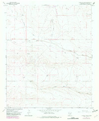
1967 Map of Lovelady Draw
USGS Topo · Published 1982About this map
Baker Ranch and Shirley Ranch anchor this high plains landscape in De Baca County, illustrating the sparse but strategic ranching infrastructure of the late 1960s. The region is defined by a network of drainage features like Lovelady Draw and Arroyo de la Mora, where water access was the primary driver of human activity. Critical water points such as Lovelady Spring, Cottonwood Well, and the Arroyo de la Mora Spring are mapped alongside numerous specialized ranching assets, including the Duke Windmill and Pursley Windmill. A single Landing Strip near Deck Ranch and a Drift Hole north of the arroyo suggest the intersection of modern transport and subterranean exploration within this traditional cattle-grazing territory. This 1967 survey, with revisions from 1979, provides an intricate look at how fences and windmills shaped the management of the New Mexico interior.
Find a feature on this map
26 named features on this map. Tap any name to fly to it.
Don’t see what you’re looking for? This feature index may not catch every label — zoom into the map to look around manually.
Map Details
Editions of this 1967 Lovelady Draw Map
2 editions found
Other maps of this area

1954 · Fort Sumner
USGS Topo · 1:250,000

1955 · Roswell
USGS Topo · 1:250,000

1958 · Fort Sumner
USGS Topo · 1:250,000

1958 · Roswell
USGS Topo · 1:250,000

1962 · Roswell
USGS Topo · 1:250,000

1967 · Deering Place
USGS Topo · 1:24,000

1967 · Dunlap NE
USGS Topo · 1:24,000

1967 · Dunlap Sill
USGS Topo · 1:24,000

1967 · Conejo Creek West
USGS Topo · 1:24,000

1967 · Swallow Nest Canyon
USGS Topo · 1:24,000