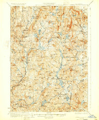
1930 Map of Lovewell Mountain
USGS Topo · Published 1933About this map
The Ashuelot River carves a path through the granite hills of Cheshire and Sullivan counties, anchoring a landscape of tight-knit villages and upland farms. This early 1930s era is defined by the transition from water-powered industry to early highway connectivity, evidenced by the presence of Loverens Mill and Gee Mill alongside the developing State Highway system. Local life is mapped through granular details like Giles Sch and Crane Sch, alongside the Advent Ch, reflecting the institutional roots of towns like Marlow and Stoddard.
Find a feature on this map
147 named features on this map. Tap any name to fly to it.
Don’t see what you’re looking for? This feature index may not catch every label — zoom into the map to look around manually.
Map Details
Editions of this 1930 Lovewell Mountain Map
4 editions found

Other maps of this area

1898 · Monadnock
USGS Topo · 1:62,500

1898 · Keene
USGS Topo · 1:62,500

1900 · Peterboro
USGS Topo · 1:62,500

1902 · Sunapee
USGS Topo · 1:62,500

1905 · Sunapee
USGS Topo · 1:62,500

1907 · Sunapee
USGS Topo · 1:62,500

1926 · Hillsboro
USGS Topo · 1:62,500

1926 · Claremont
USGS Topo · 1:62,500

1927 · Bellows Falls
USGS Topo · 1:48,000

1928 · Mount Kearsarge
USGS Topo · 1:62,500